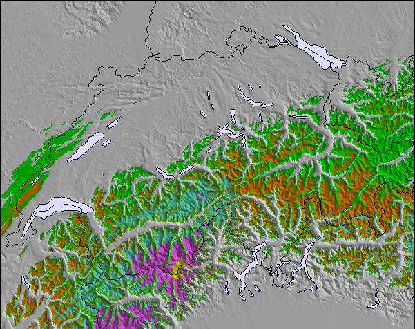
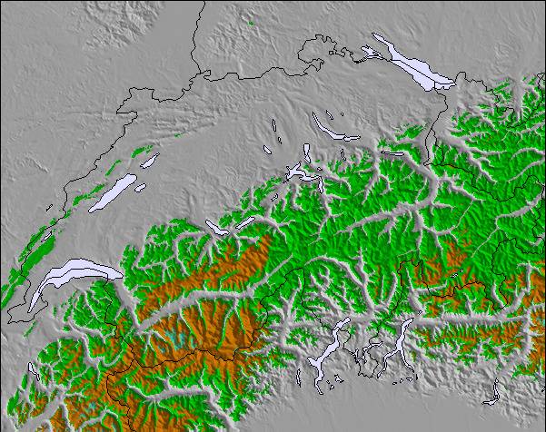
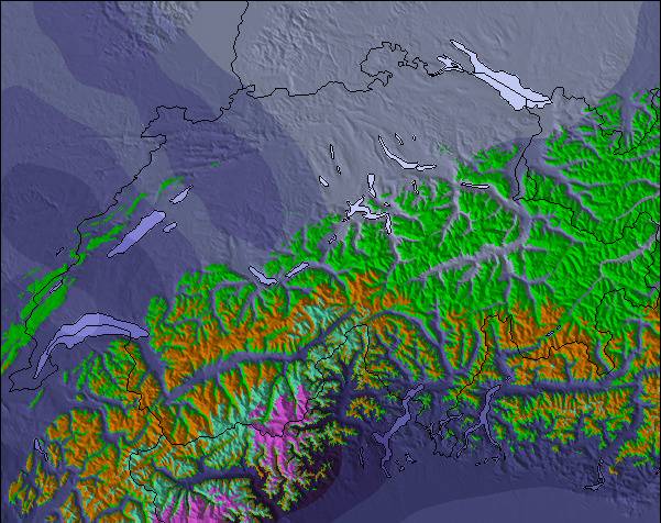
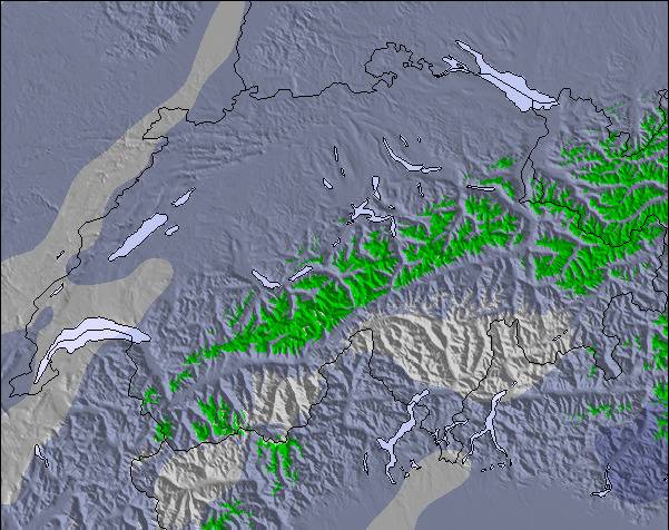
上記の表には Brandnertal (Brand und Bürserberg) の2000 m の特定高度における天気予報が表示されています。高度な気候モデルによって、 Brandnertal (Brand und Bürserberg) の山頂、中腹、麓にあるスキーステーションの雪予報を提供することができます。その他の高度の天気予報にアクセスするには、テーブルの上のタブナビゲーションをお使いください。より広範囲の天気予報には、 Austria の天気図をご覧ください。
I first came here 25 years ago as a 12 year old boy with my father. I have now returned with my daughter who is only 3 and skiing for the first time. Brand is a superb little Austrian resort with fantastic facilities for children. We stayed at the 4 star Sporthotel Beck which has a excellent kids club and is part of the Kinder hotels group. With a nursery slope in the village, horse riding, sledging, quad biking and an excellent kids club. Brand is ideal for beginners and intermediate skiers. There are a some good apres bars and some nice restaurants, but don't come here for mad apres-ski as you wont find it - head to St Anton or Ischgl for that. Although like many resorts in Austria the village is quite low we had plenty of snow and some great powder days. So if you are a first time skier or are taking the kids and are looking for a quaint little Austrian resort - head to Brandnertal.
I first came here 25 years ago as a 12 year old boy with my father. I have now returned with my daughter who is only 3 and skiing for the first time. Brand is a superb little Austrian resort with fantastic facilities for children. We stayed at the 4 star Sporthotel Beck which has a excellent kids club and is part of the Kinder hotels group. With a nursery slope in the village, horse riding, sledging, quad biking and an excellent kids club. Brand is ideal for beginners and intermediate skiers. There are a some good apres bars and some nice restaurants, but don't come here for mad apres-ski as you wont find it - head to St Anton or Ischgl for that. Although like many resorts in Austria the village is quite low we had plenty of snow and some great powder days. So if you are a first time skier or are taking the kids and are looking for a quaint little Austrian resort - head to Brandnertal.
下記の Brandnertal (Brand und Bürserberg)スキー天気ウィジェットを使って、無料で外部のウェブサイトに組み込むことができます。これによりBrandnertal (Brand und Bürserberg) の雪の予報と現在の気象条件の毎日の概況が分かります。フィード設定のページにアクセスし、簡単な3つのステップを踏むだけでカスタムhtmlコードスニペットを取得することができ、ご自身のサイトに貼り付けていただけます。ご自身のウェブサイトに合わせて、雪予報の高度(山の頂上、中腹、ふもとのリフト)やメートル法/ポンド・ヤード法を選ぶことができます。 クリックしてコードを取得


 Nearest