

Portillo Re-Opens To Guests Arriving By Helicopter
Chile’s famous Portillo ski resort is reported to have re-opened to guests arriving by helicopter after being cut off by road for more than two weeks by over 6m/20 feet of snowfall.

Next 3 days weather summary:並雨 (合計 15.0mm), 最大 水曜日の夜に. 暖かい (最大 26°C 火曜日の午後に, 最小 17°C 火曜日の夜に). 風は通常微風. | 4 - 6日間のBrandnertal (Brand und Bürserberg) 天気予報の概況豪雨 (合計 39.0mm), 最大 木曜日の午後の間. 暖かい (最大 22°C 木曜日の午後に, 最小 12°C 木曜日の夜に). 風は通常微風. | |||||||||||||||||
月曜日 3 | 火曜日 4 | 水曜日 5 | 木曜日 6 | 金曜日 7 | 土曜日 8 | |||||||||||||
午前 | 午後 | 夜] | 午前 | 午後 | 夜] | 午前 | 午後 | 夜] | 午前 | 午後 | 夜] | 午前 | 午後 | 夜] | 午前 | 午後 | 夜] | |
一部曇り | 曇り | 晴れる | 晴れる | 晴れる | にわか雨 | 雷の恐れ | 雷の恐れ | にわか雨 | 雷の恐れ | 雷の恐れ | 豪雨 | 小雨 | 雷の恐れ | にわか雨 | 晴れる | 雷の恐れ | にわか雨 | |
km/h | ||||||||||||||||||
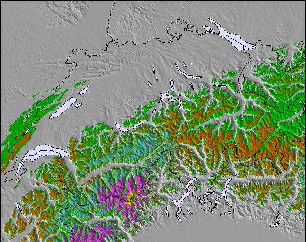
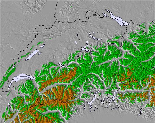
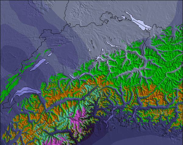
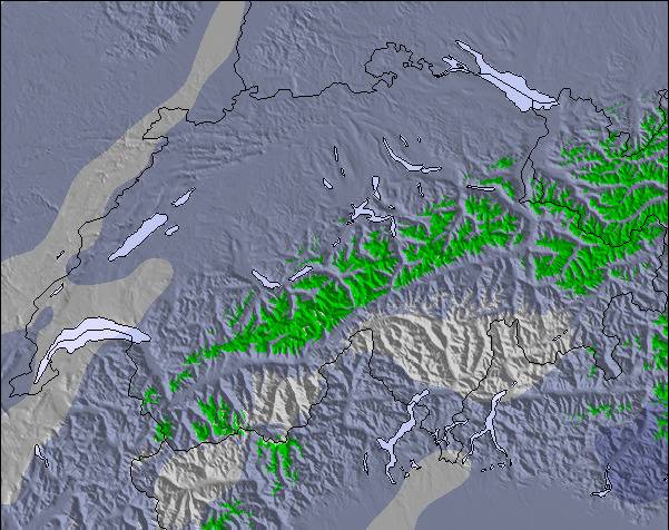
雪 マップ |  |  |  |  |  |  | ||||||||||||
— | — | — | — | — | — | — | — | — | — | — | — | — | — | — | — | — | — | |
mm | — | — | — | — | — | 4 | 1 | 2 | 8 | 1 | 14 | 17 | 1 | 2 | 1 | — | 2 | 1 |
max °C | 24 | 25 | 22 | 23 | 26 | 23 | 20 | 23 | 19 | 20 | 22 | 14 | 13 | 16 | 15 | 17 | 18 | 17 |
min °C | 21 | 24 | 20 | 20 | 25 | 17 | 18 | 23 | 17 | 19 | 17 | 12 | 12 | 15 | 14 | 14 | 18 | 16 |
chill °C | 21 | 24 | 20 | 20 | 25 | 17 | 18 | 23 | 17 | 19 | 17 | 12 | 12 | 15 | 14 | 14 | 18 | 16 |
湿度の高い % | 37 | 42 | 53 | 41 | 37 | 75 | 64 | 53 | 67 | 61 | 83 | 86 | 93 | 85 | 84 | 74 | 74 | 74 |
凍結高度 m | 4550 | 4550 | 4500 | 4450 | 4650 | 4400 | 4350 | 4450 | 4350 | 4350 | 4350 | 4000 | 4050 | 4050 | 4050 | 4050 | 4050 | 4200 |
6:01 | — | — | 6:01 | — | — | 6:03 | — | — | 6:05 | — | — | 6:05 | — | — | 6:07 | — | — | |
— | — | 8:52 | — | — | 8:50 | — | — | 8:49 | — | — | 8:46 | — | — | 8:45 | — | — | 8:44 | |
Go pro and carve into:
最新の雪レポート Brandnertal (Brand und Bürserberg):
| 雪上部の深さ | 0 cm |
|---|---|
| 雪下部の深さ | 0 cm |
| 新雪の深さ | — |
| 最後の降雪 | 16 May 2026 |
0.0 | ブルバードパウダーの日 新雪、おおむね晴れ、微風 |
|---|---|
0.0 | パウダーの日 新雪、時々晴れ、風あり |
0.0 | ブルーバードの日 平均的な雪、おおむね晴れ、微風 |
上記の表には Brandnertal (Brand und Bürserberg) の1446 m の特定高度における天気予報が表示されています。高度な気候モデルによって、 Brandnertal (Brand und Bürserberg) の山頂、中腹、麓にあるスキーステーションの雪予報を提供することができます。その他の高度の天気予報にアクセスするには、テーブルの上のタブナビゲーションをお使いください。より広範囲の天気予報には、 Austria の天気図をご覧ください。
ここをクリックし凍結高度や我々の気温の予測の仕方についてさらにご覧ください。
リゾート名は Brandnertal とも表示
全体 4.1 基づいた 14 投票 および 3 レビュー
This is a fantastic family resort. We ski all over Europe with our 3 children and we come back to this resort at least once a year (for the last 10 years). It's quiet, it's got a lot of very good runs and it's good value (not cheap but you get value for money). The snow fall is reliable and frequent. If you want nightlife go to St Anton. Come here if you want a great week of skiing in a friendly well run clean safe resort with good lifts and decent mountain restaurants which will not bankrupt you go to Brand
United KingdomのMike SHAWが記述:
This is a fantastic family resort. We ski all over Europe with our 3 children and we come back to this resort at least once a year (for the last 10 years). It's quiet, it's got a lot of very good runs and it's good value (not cheap but you get value for money). The snow fall is reliable and frequent. If you want nightlife go to St Anton. Come here if you want a great week of skiing in a friendly well run clean safe resort with good lifts and decent mountain restaurants which will not bankrupt you go to Brand
Brandnertal (Brand und Bürserberg)のレビューをあと2読むか、ご自身のレビューを送ってください

 Nearest