
Uludağスキー リゾート ガイド (Uludag)
ゲレンデの統計
2322m
555m
1767m
- スキー場の広さ:-
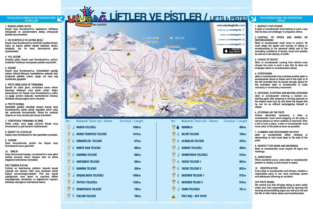
- ゲレンデ:26
- 人工雪製造:Yes
- ハーフパイプ:0
- 地域公園:1
- X-国:20 km
- 初心者45%
- 中級者35%
- 高度20%

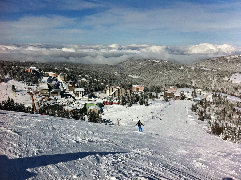
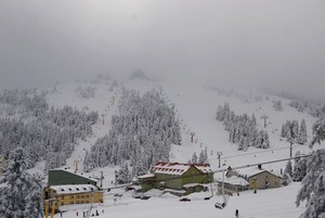
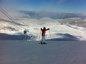
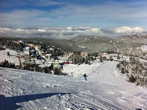
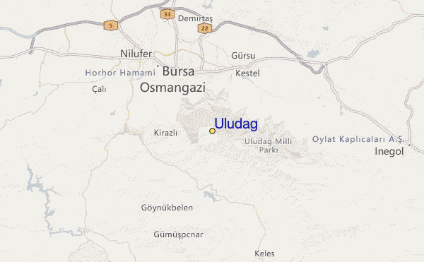
Uludağ is the fabled Mount Olympus of Mysia. It is known in mythology as the place where the gods watched the Trojan war. It is a western extension of the Pontic mountain ranges. Its name means 'Big mountain' - the highest mountain in Western Anatolia, culminating at Kara Tepe (2543m). The ski centre, in the Uludağ National Park, is 36km south of Bursa (a city of 600,000 people) accessible, either along a sealed road, or else by a combined cable-car/bus route that may be preferable when the road is icy. The skiing at Uludağ is mostly intermediate on lightly forested slopes that are usually open from December until late March. Heli-skiing is also available and there are vast off-piste bowls to explore, albeit a threat to conservation within the national park. There are 27 hotels, 15 of which are privately owned, providing over 3000 beds at present. Further development is underway.
旅行
- 最寄りの空港:Istanbul
- 最寄りの鉄道駅:Istanbul
- 観光案内所の電話番号::90 549 788 87 88
- 観光案内所のウェブサイト:www.uludaginfo.com
- ゲレンデ沿いにある宿泊施設:はい
 14
14 -
-
リフト
- シーズン開始:20 Dec 2025
- シーズン終了:31 Mar 2026
- Lifts:22 (1 gondola, 5 chairlifts, 16 surface lifts)
 1
1 5
5 16
16
Uludağのスキー リゾート マネージャーから届いたお知らせ&ニュース
Uludağ Official Website: www.uludaginfo.com
Online Skipass Sales: www.uludagshop.com
Contact Information
Mail: [email protected]
Phone: +90 (549) 788 87 88
最新の雪レポート雪レポートを全部見る
- 発行:
- 前回の降雪:—
- 雪の深さ(頂上付近):–
- 雪の深さ(麓付近):–
- ゲレンデ:—
- ゲレンデ外:—
今日の天気 (2044 m)雪予報を全部見る
| 午前 | 16 °C | Fレベル 4550 m | ||
| 午後 | 17 °C | Fレベル 4550 m | ||
| 夜] | 17 °C | Fレベル 4600 m |
Uludağ (Uludag) に近いリゾート。以下を含みます。:
- Kartepe 102km
- Bozdag 216km
- Kartalkaya 233km
- Davraz 297km
- Denizli Kayak Merkezi 304km
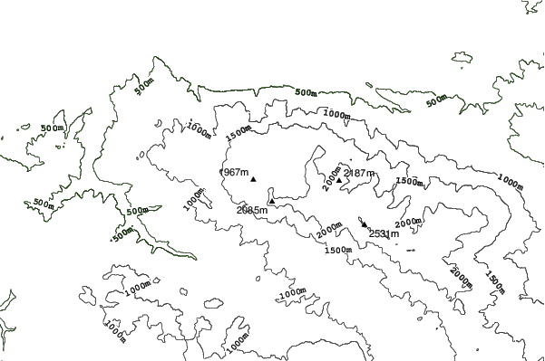
Uludağロケーション地図


(また詳細なを参照してください。Uludağ の天気図によって、現在と将来の雪の状況がビジュアルで分かる概要をご覧いただけます。)
Uludağのビジターによるレビュー
TurkeyのTonguçが記述:
İstanbul'a yakınlığından dolayı her sene bir kez şansımı denerim. Hava mükemmel ve işletmenin pistleri düzeltmemek için hiçbir bahanesi kalmadıysa iyi şartlarla karşılaşma ihtimaliniz var. Ancak %90 ihtimalle bakamsız pistler, bakımsız liftler, ilgisiz personel, fahiş fiyatlar sizi bekliyor olacak.
Biraz kızak, biraz telesiyej manzarası, biraz sosyalleşme, sucuk ekmek, bangır bangır müzik eşliğinde etrafı seyretmece, karlarda yuvarlanmaca diyorsanız güzel zaman geçirebilirsiniz. Ancak insan gibi kayak/snowboard yapmak gibi bir beklentiniz varsa hayal kırıklığına uğrama ihtimaliniz çok yüksek.
Tavsiye etmem.
 Uludağに最も近い都市の予測
- Bursa, Turkey12km
- Kestel, Turkey13km
- Inegeul, Turkey33km
- Cius, Turkey37km
- Orhangazi, Turkey45km
 Uludağに最も近いサーフブレイク
- Ağlayankaya Plajı (Aglayankaya), Turkey126km
- Kumcağız (Kumcagiz), Turkey149km
- Karasu, Turkey174km
- Silistar, Bulgaria233km
- Ahtopol, Bulgaria243km
 Uludağに最も近い山の頂上
- Uludag, Turkey4km
- Elati (mountain), Turkey168km
- Kula (volcano), Turkey177km
- Mount Ida (Turkey), Turkey201km
- Mahya Dagl, Turkey226km
Uludağ (Uludag)の周りにあるリゾートと山頂

 Nearest