
The Summit at Snoqualmieスキー リゾート ガイド
ゲレンデの統計
1646m
671m
975m
- スキー場の広さ:-
- ゲレンデ:65
- 人工雪製造:-
- ハーフパイプ:1
- 地域公園:2
- X-国:55 km
- 初心者20%
- 中級者45%
- 高度35%

This is a duplicated entry. See Summit at Snoqualime pages.
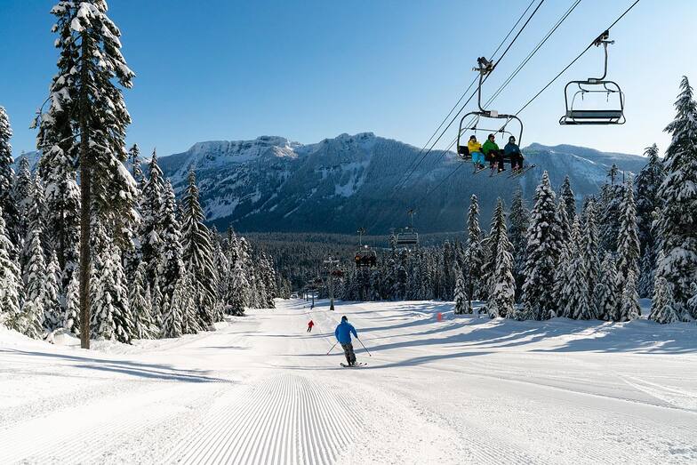
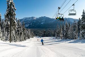
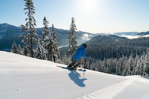
The Summit at Snoqualmie, in the United States (Washington State), is a large resort with 26 lifts (20 chair lifts & 6 surface lifts) that offers skiers an impressive 695 metres (2280 feet) of vertical descent. The Summit at Snoqualmie has 114 trails. The Summit at Snoqualmie is best suited to intermediate skiers and snowboarders but there is some terrain for beginners and advanced skiers. There are 55 kilometers (34 miles) of cross country ski trails at The Summit at Snoqualmie. For snowboarders, there are 3 terrain parks and a half pipe. The nearest airport is at Seattle and the nearest train station to The Summit at Snoqualmie is at Seattle.
旅行
- 最寄りの空港:Seattle
- 最寄りの鉄道駅:Seattle
- 観光案内所の電話番号::+14254347669
- 観光案内所のウェブサイト:www.summit-at-snoqualmie.com
- ゲレンデ沿いにある宿泊施設:-
 8
8 -
-
リフト
- シーズン開始:
- シーズン終了:
- Lifts:33 (23 chairlifts, 10 surface lifts)
 -
- 23
23 10
10
最新の雪レポート雪レポートを全部見る
- 発行:
- 前回の降雪:—
- 雪の深さ(頂上付近):–
- 雪の深さ(麓付近):–
- ゲレンデ:—
- ゲレンデ外:—
今日の天気 (1311 m)雪予報を全部見る
| 午前 | 16 °C | Fレベル 4250 m | ||
| 午後 | 18 °C | Fレベル 4100 m | ||
| 夜] | 16 °C | Fレベル 3850 m |
The Summit at Snoqualmie に近いリゾート。以下を含みます。:
- Alpental At The Summit 51km
- Summit at Snoqualmie 52km
- Stevens Pass 66km
- Crystal Mountain 77km
- White Pass Village 110km
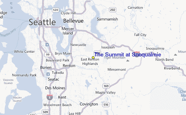
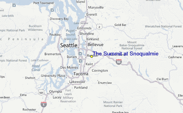
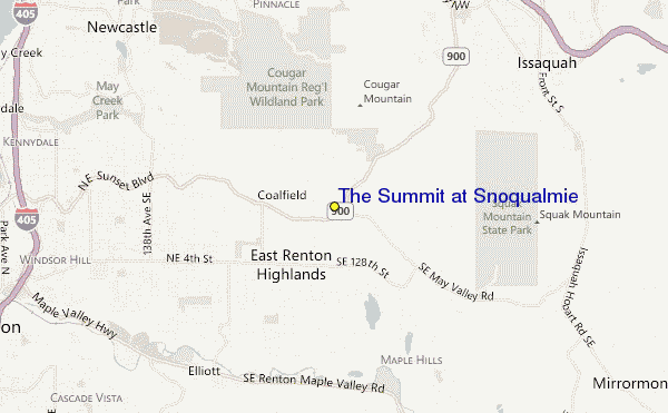
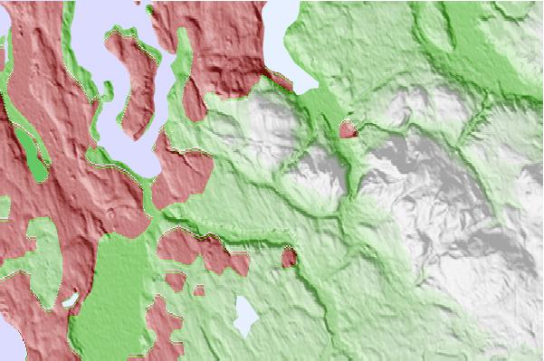
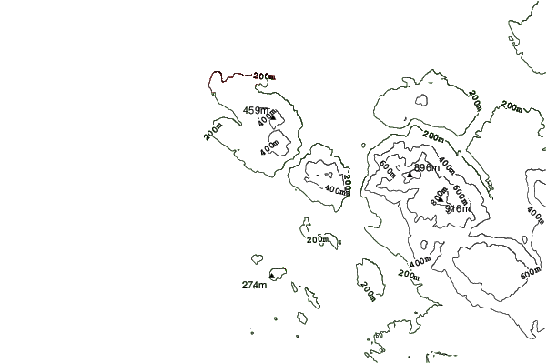
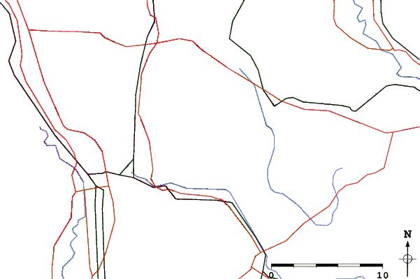
The Summit at Snoqualmieロケーション地図
(また詳細なを参照してください。The Summit at Snoqualmie の天気図によって、現在と将来の雪の状況がビジュアルで分かる概要をご覧いただけます。)
The Summit at Snoqualmieのビジターによるレビュー
United StatesのCoryが記述:
Warning: the map location and forecasts are not correct for this listing for The Summit at Snoqualmie.
For some reason, this shows it on the south side of Cougar Mountain, nowhere near Snoqualmie Pass.
The correct one is snow-forecast.com/resorts/Snoqualmie/6day/mid
[note from the editor: the following text can be seen on the Resort Guide page: This is a duplicated entry. See Summit at Snoqualime pages.)
 The Summit at Snoqualmieに最も近い都市の予測
- Issaquah, United States6km
- Renton, United States9km
- West Lake Sammamish, United States9km
- Bellevue, United States12km
- Sammamish, United States16km
 The Summit at Snoqualmieに最も近いサーフブレイク
- Fort. Ebey, United States95km
- Super green, United States112km
- Elwha, United States131km
- Crescent, United States141km
- Whiskey Creek, United States145km
 The Summit at Snoqualmieに最も近い山の頂上
- Cougar Mountain, United States4km
- Squak Mountain, United States5km
- Tiger Mountain, United States12km
- Rattlesnake Mountain, United States23km
- Little Si, United States26km
The Summit at Snoqualmieの周りにあるリゾートと山頂
 Nearest