


America’s Next Indoor Snow Centre Takes Shape
Construction of a new indoor snow centre for skiers, boarders and tubers appears to be making good progress at Heritage Farm in Wayne County, West Virginia.

Next 4 days weather summary:少量の雨 (合計 6.0mm), 大抵降る 日曜日の夜に. 暖かい (最大 23°C 水曜日の午後に, 最小 9°C 火曜日の夜に). 風は通常微風. | 5 - 7日間のItter (SkiWelt) 天気予報の概況並雨 (合計 14.0mm), 最大 木曜日の午後に. 暖かい (最大 26°C 土曜日の午後に, 最小 8°C 木曜日の夜に). 風は通常微風. | |||||||||||||||
月曜日 20 | 火曜日 21 | 水曜日 22 | 木曜日 23 | 金曜日 24 | ||||||||||||
夜] | 午前 | 午後 | 夜] | 午前 | 午後 | 夜] | 午前 | 午後 | 夜] | 午前 | 午後 | 夜] | 午前 | 午後 | 夜] | |
にわか雨 | 晴れる | にわか雨 | 一部曇り | 一部曇り | にわか雨 | にわか雨 | 晴れる | 一部曇り | にわか雨 | 小雨 | 雷の恐れ | にわか雨 | 晴れる | 晴れる | 一部曇り | |
km/h | ||||||||||||||||
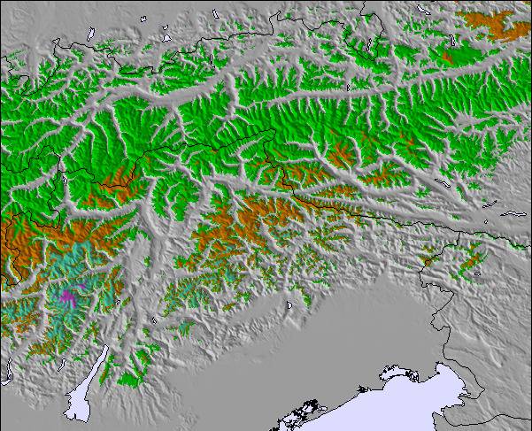
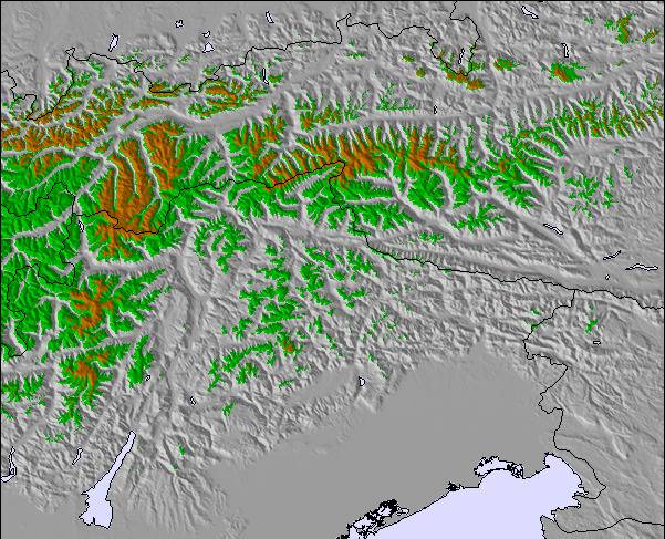
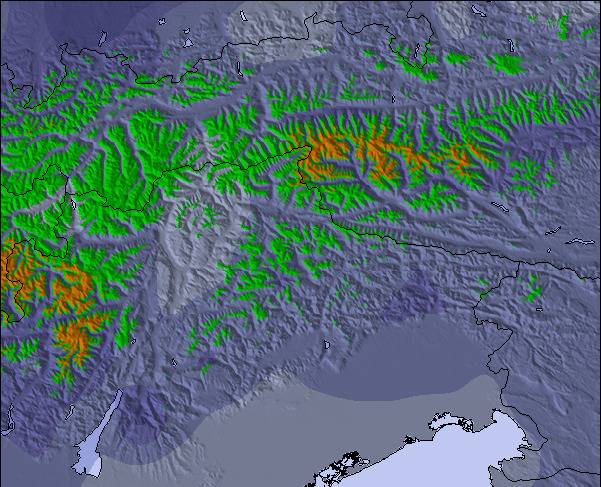
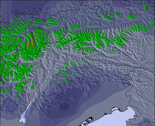
雪 マップ |  |  |  |  |  |  | ||||||||||
— | — | — | — | — | — | — | — | — | — | — | — | — | — | — | — | |
mm | 1 | — | 2 | — | — | 1 | 2 | — | — | 1 | 3 | 6 | 4 | — | — | — |
max °C | 16 | 20 | 21 | 18 | 19 | 20 | 15 | 20 | 23 | 18 | 14 | 16 | 13 | 19 | 22 | 17 |
min °C | 11 | 14 | 21 | 10 | 14 | 19 | 9 | 14 | 23 | 12 | 13 | 15 | 8 | 12 | 22 | 11 |
chill °C | 11 | 14 | 21 | 10 | 14 | 19 | 9 | 14 | 23 | 12 | 13 | 15 | 8 | 12 | 22 | 11 |
湿度の高い % | 87 | 68 | 56 | 80 | 60 | 56 | 81 | 50 | 40 | 61 | 87 | 83 | 81 | 51 | 34 | 61 |
凍結高度 m | 3300 | 3350 | 3250 | 3300 | 3200 | 2950 | 2800 | 3300 | 3200 | 3050 | 2800 | 2800 | 2600 | 3000 | 3350 | 3650 |
— | 5:33 | — | — | 5:35 | — | — | 5:35 | — | — | 5:37 | — | — | 5:37 | — | — | |
— | — | — | 9:00 | — | — | 8:59 | — | — | 8:58 | — | — | 8:57 | — | — | 8:55 | |
Go pro and carve into:
最新の雪レポート Itter (SkiWelt):
| 雪上部の深さ | — |
|---|---|
| 雪下部の深さ | — |
| 新雪の深さ | — |
| 最後の降雪 | 16 May 2026 |
0.0 | ブルバードパウダーの日 新雪、おおむね晴れ、微風 |
|---|---|
0.0 | パウダーの日 新雪、時々晴れ、風あり |
0.0 | ブルーバードの日 平均的な雪、おおむね晴れ、微風 |

 Nearest