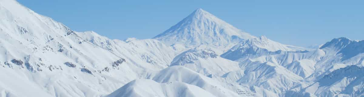


America’s Next Indoor Snow Centre Takes Shape
Construction of a new indoor snow centre for skiers, boarders and tubers appears to be making good progress at Heritage Farm in Wayne County, West Virginia.

Next 3 days weather summary:豪雨 (合計 26.0mm), 最大 火曜日の夜間. 暖かい (最大 25°C 火曜日の朝に, 最小 12°C 水曜日の夜に). 風は通常微風. | 4 - 6日間のSki Bromont 天気予報の概況大部分は乾燥. 暖かい (最大 27°C 土曜日の午後に, 最小 14°C 金曜日の夜に). 風は通常微風. | |||||||||||||||||
火曜日 21 | 水曜日 22 | 木曜日 23 | 金曜日 24 | 土曜日 25 | 日曜日 26 | |||||||||||||
午前 | 午後 | 夜] | 午前 | 午後 | 夜] | 午前 | 午後 | 夜] | 午前 | 午後 | 夜] | 午前 | 午後 | 夜] | 午前 | 午後 | 夜] | |
一部曇り | 雷の恐れ | にわか雨 | にわか雨 | にわか雨 | 曇り | 一部曇り | 晴れる | 晴れる | 晴れる | 晴れる | 晴れる | 晴れる | 晴れる | 晴れる | 一部曇り | 一部曇り | 晴れる | |
km/h | ||||||||||||||||||
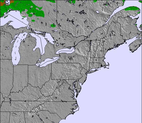
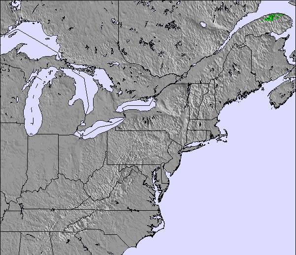
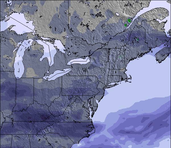
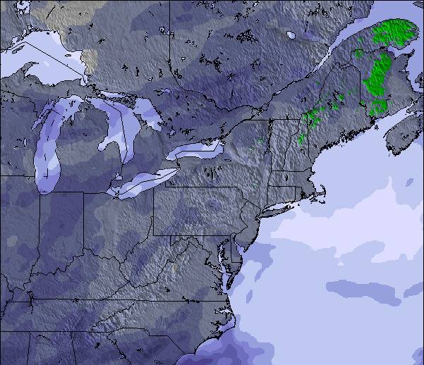
雪 マップ |  |  |  |  |  |  | ||||||||||||
— | — | — | — | — | — | — | — | — | — | — | — | — | — | — | — | — | — | |
mm | — | 2 | 20 | 3 | 1 | — | — | — | — | — | — | — | — | — | — | — | — | — |
max °C | 25 | 25 | 19 | 18 | 16 | 14 | 17 | 20 | 17 | 22 | 24 | 20 | 24 | 27 | 21 | 24 | 26 | 21 |
min °C | 20 | 23 | 17 | 15 | 16 | 12 | 12 | 20 | 13 | 17 | 24 | 14 | 19 | 27 | 16 | 19 | 26 | 17 |
chill °C | 20 | 23 | 17 | 14 | 15 | 10 | 10 | 20 | 12 | 17 | 24 | 14 | 19 | 27 | 16 | 19 | 26 | 17 |
湿度の高い % | 54 | 73 | 94 | 95 | 70 | 75 | 51 | 50 | 63 | 53 | 45 | 69 | 49 | 43 | 65 | 51 | 44 | 67 |
凍結高度 m | 3900 | 4050 | 3900 | 3500 | 3350 | 3150 | 2300 | 3000 | 2900 | 3300 | 3600 | 3700 | 3900 | 3900 | 3600 | 3700 | 3700 | 3750 |
5:22 | — | — | 5:22 | — | — | 5:24 | — | — | 5:24 | — | — | 5:26 | — | — | 5:26 | — | — | |
— | — | 8:30 | — | — | 8:29 | — | — | 8:28 | — | — | 8:27 | — | — | 8:25 | — | — | 8:24 | |
Go pro and carve into:
雪崩情報: Avalanche Canada
最新の雪レポート Ski Bromont:
| 雪上部の深さ | — |
|---|---|
| 雪下部の深さ | — |
| 新雪の深さ | — |
| 最後の降雪 | 20 Apr 2026 |
0.0 | ブルバードパウダーの日 新雪、おおむね晴れ、微風 |
|---|---|
0.0 | パウダーの日 新雪、時々晴れ、風あり |
0.0 | ブルーバードの日 平均的な雪、おおむね晴れ、微風 |
全体 3.2 基づいた 9 投票 および 3 レビュー
The resort stands on 3 hilltops with 6 main hill sides and a 'bunny' hill for beginners. Perfect place to learn skiing / boarding as most of the resort is on groomed, gentle terrain. Much cheaper than Tremblant and much bigger than St-Sauveur (why do they even call that a mountain?) They have some of the best snowmaking and grooming equipment in Quebec making them shine when conditions are bulletproof all around. They groom most runs twice during the day which is good when there is no snow. But when it does snow, it mixes the good snow with the base and packs it. Plus, be sure the masses will be there to ski it. You'd find it hard to see anything of a 20+cm dump 2 days after it has fallen; this is no joke. I've seen the whole mountain getting tracked in less than three hours on busy powder days. The hill gets a lot of wind and cold which can occasionally shut down lifts and render powder conditions into bulletproof wind crust overnight but that's what east coast skiing is all about.
Canadaのbromdawggerが記述:
The resort stands on 3 hilltops with 6 main hill sides and a 'bunny' hill for beginners. Perfect place to learn skiing / boarding as most of the resort is on groomed, gentle terrain. Much cheaper than Tremblant and much bigger than St-Sauveur (why do they even call that a mountain?) They have some of the best snowmaking and grooming equipment in Quebec making them shine when conditions are bulletproof all around. They groom most runs twice during the day which is good when there is no snow. But when it does snow, it mixes the good snow with the base and packs it. Plus, be sure the masses will be there to ski it. You'd find it hard to see anything of a 20+cm dump 2 days after it has fallen; this is no joke. I've seen the whole mountain getting tracked in less than three hours on busy powder days. The hill gets a lot of wind and cold which can occasionally shut down lifts and render powder conditions into bulletproof wind crust overnight but that's what east coast skiing is all about.

 Nearest