

Portillo Storm Snowfall Total Passes 5m / 17 Feet
A snow storm that has now continued for nine days has taken Chilean ski resort Portillo to a snowfall total of 5.2 metres (17 feet) so far, with more snow forecast.

Next 4 days weather summary:少量の雨 (合計 9.0mm), 大抵降る 日曜日の夜に. 暖かい (最大 21°C 火曜日の午後に, 最小 15°C 日曜日の夜に). 風が強くなる (そよ風 南西から 日曜日の夜に, 強風 南から 火曜日の夜までに). | 5 - 7日間のMont Sutton 天気予報の概況豪雨 (合計 30.0mm), 最大 水曜日の夜間. 非常に穏やか (最大 19°C 土曜日の午後に, 最小 13°C 水曜日の夜に). 風は通常微風. | |||||||||||||||
月曜日 27 | 火曜日 28 | 水曜日 29 | 木曜日 30 | 金曜日 31 | ||||||||||||
夜] | 午前 | 午後 | 夜] | 午前 | 午後 | 夜] | 午前 | 午後 | 夜] | 午前 | 午後 | 夜] | 午前 | 午後 | 夜] | |
にわか雨 | 一部曇り | 雷の恐れ | にわか雨 | 一部曇り | 一部曇り | 一部曇り | 小雨 | 小雨 | 並雨 | 並雨 | 小雨 | にわか雨 | 小雨 | 雷の恐れ | にわか雨 | |
km/h | ||||||||||||||||
雪 マップ |  |  |  |  |  |  | ||||||||||
— | — | — | — | — | — | — | — | — | — | — | — | — | — | — | — | |
mm | 2 | — | 2 | 2 | — | — | — | 1 | 2 | 10 | 6 | 2 | 3 | 1 | 5 | 2 |
max °C | 18 | 17 | 19 | 18 | 19 | 21 | 19 | 16 | 16 | 14 | 14 | 15 | 15 | 16 | 18 | 17 |
min °C | 15 | 16 | 18 | 16 | 17 | 20 | 16 | 16 | 15 | 13 | 14 | 15 | 14 | 15 | 17 | 15 |
chill °C | 15 | 16 | 18 | 15 | 16 | 20 | 14 | 14 | 14 | 11 | 12 | 14 | 13 | 15 | 17 | 15 |
湿度の高い % | 74 | 76 | 69 | 76 | 69 | 67 | 83 | 85 | 89 | 77 | 97 | 93 | 93 | 88 | 83 | 89 |
凍結高度 m | 3600 | 3550 | 3750 | 3800 | 3800 | 4000 | 4000 | 3850 | 3750 | 3650 | 3800 | 3750 | 3750 | 3800 | 4000 | 4100 |
— | 5:28 | — | — | 5:30 | — | — | 5:31 | — | — | 5:31 | — | — | 5:33 | — | — | |
— | — | — | 8:22 | — | — | 8:22 | — | — | 8:21 | — | — | 8:20 | — | — | 8:17 | |
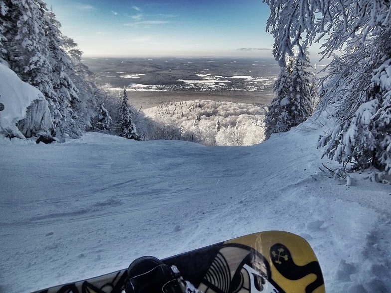
Go pro and carve into:
雪崩情報: Avalanche Canada
最新の雪レポート Mont Sutton:
| 雪上部の深さ | — |
|---|---|
| 雪下部の深さ | — |
| 新雪の深さ | — |
| 最後の降雪 | 7 May 2026 |
0.0 | ブルバードパウダーの日 新雪、おおむね晴れ、微風 |
|---|---|
0.0 | パウダーの日 新雪、時々晴れ、風あり |
0.0 | ブルーバードの日 平均的な雪、おおむね晴れ、微風 |
全体 3.8 基づいた 17 投票 および 4 レビュー
Beautiful ski hill especially for good skiers.
CanadaのLynda Gが記述:
Beautiful ski hill especially for good skiers.

 Nearest