


America’s Next Indoor Snow Centre Takes Shape
Construction of a new indoor snow centre for skiers, boarders and tubers appears to be making good progress at Heritage Farm in Wayne County, West Virginia.

Next 4 days weather summary:少量の雨 (合計 7.0mm), 大抵降る 日曜日の夜に. 非常に穏やか (最大 15°C 月曜日の午後に, 最小 9°C 日曜日の夜に). 風は通常微風. | 5 - 7日間のKandersteg 天気予報の概況大部分は乾燥. 非常に穏やか (最大 18°C 土曜日の午後に, 最小 8°C 木曜日の夜に). 風は通常微風. | |||||||||||||||
月曜日 20 | 火曜日 21 | 水曜日 22 | 木曜日 23 | 金曜日 24 | ||||||||||||
夜] | 午前 | 午後 | 夜] | 午前 | 午後 | 夜] | 午前 | 午後 | 夜] | 午前 | 午後 | 夜] | 午前 | 午後 | 夜] | |
にわか雨 | 晴れる | 雷の恐れ | にわか雨 | 雷の恐れ | にわか雨 | 晴れる | 晴れる | 晴れる | 晴れる | 一部曇り | 一部曇り | 晴れる | 晴れる | 晴れる | 晴れる | |
km/h | ||||||||||||||||
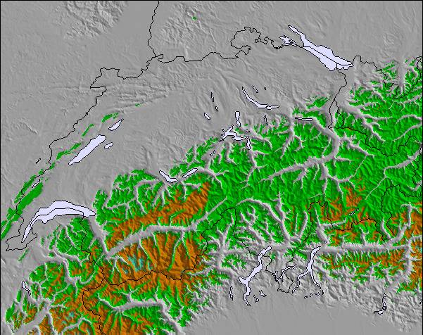
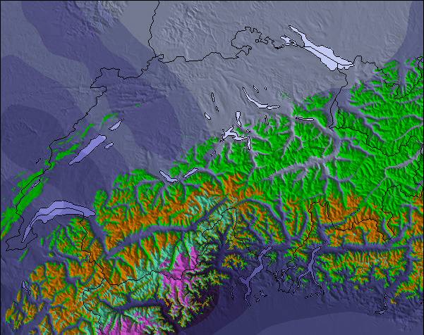
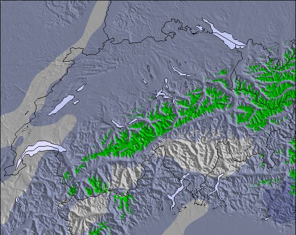
雪 マップ |  |  |  |  |  |  | ||||||||||
— | — | — | — | — | — | — | — | — | — | — | — | — | — | — | — | |
mm | 1 | — | 2 | 1 | 1 | 2 | — | — | — | — | — | — | — | — | — | — |
max °C | 12 | 13 | 15 | 13 | 12 | 13 | 11 | 13 | 14 | 12 | 11 | 12 | 10 | 13 | 15 | 13 |
min °C | 9 | 11 | 14 | 10 | 10 | 13 | 9 | 10 | 14 | 9 | 9 | 12 | 8 | 10 | 15 | 11 |
chill °C | 8 | 11 | 14 | 10 | 9 | 12 | 9 | 10 | 14 | 9 | 9 | 11 | 8 | 10 | 15 | 11 |
湿度の高い % | 72 | 65 | 61 | 62 | 62 | 59 | 55 | 34 | 51 | 52 | 55 | 53 | 53 | 23 | 39 | 43 |
凍結高度 m | 3750 | 3600 | 3750 | 3900 | 3600 | 3450 | 3800 | 3850 | 3700 | 3700 | 3300 | 3400 | 3900 | 4150 | 4000 | 4150 |
— | 5:54 | — | — | 5:56 | — | — | 5:58 | — | — | 5:58 | — | — | 6:00 | — | — | |
— | — | — | 9:14 | — | — | 9:13 | — | — | 9:12 | — | — | 9:10 | — | — | 9:09 | |
Go pro and carve into:
最新の雪レポート Kandersteg:
| 雪上部の深さ | — |
|---|---|
| 雪下部の深さ | — |
| 新雪の深さ | — |
| 最後の降雪 | 16 May 2026 |
0.0 | ブルバードパウダーの日 新雪、おおむね晴れ、微風 |
|---|---|
0.0 | パウダーの日 新雪、時々晴れ、風あり |
0.0 | ブルーバードの日 平均的な雪、おおむね晴れ、微風 |
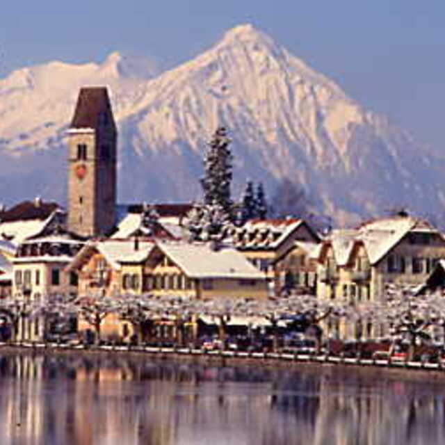
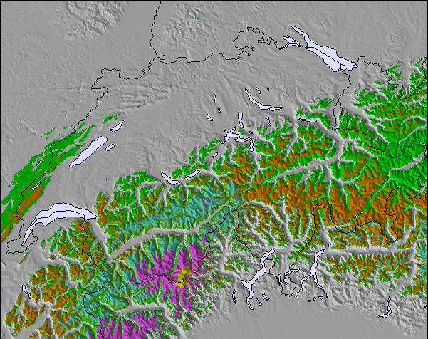
上記の表には Kandersteg の1960 m の特定高度における天気予報が表示されています。高度な気候モデルによって、 Kandersteg の山頂、中腹、麓にあるスキーステーションの雪予報を提供することができます。その他の高度の天気予報にアクセスするには、テーブルの上のタブナビゲーションをお使いください。より広範囲の天気予報には、 Switzerland の天気図をご覧ください。
ここをクリックし凍結高度や我々の気温の予測の仕方についてさらにご覧ください。

 Nearest