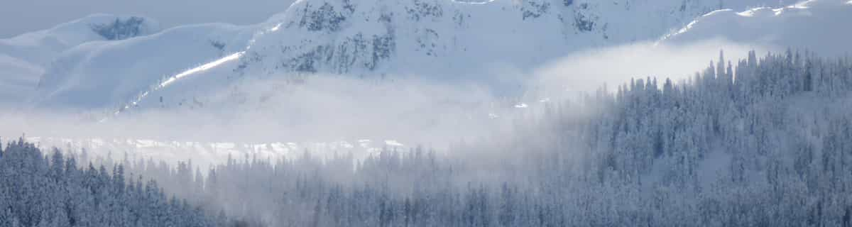
One of the best resorts in Germany! (maybe the Alps). When me and my family went to Berchtesgaden in February I was looking forward to the holiday but it surpassed even my expectations! I realised when I got there many people and websites had common misconception about Berchtesgaden, thinking it was mainly a cross-country ski resort. Well, you would be very wrong. I realised that although many websites state that there are only a few lifts, that is only one of the areas in the resort. There are 5 main areas in the resort (Jenner, Rossfeld, Hochschwarzeck, Gotschen (world cup area) and Gutshof/Obersalzburg ) all of these equal a huge ski area which has an incredible 30 lifts! Yes, they may not be linked but still are within 20 mins drive of each other. This means it rivals even Garmisch (24 lifts) in size. Although people may say the skiing is low altitude and therefore bad snow this is simply not true. nearly all the slopes are north facing and when we were there in February there was not a worry of too little snow but too much, having, when we got there, 3 metres of snow on the ground making great powder conditions! This is because Berchtesgaden is more inland than many alpine resorts so does not get as much warm Mediterranean blasts in a bad season. So next time when thinking of a ski resort in the Alps, think Berchtesgaden for a great family holiday for skiers and non-skiers alike for a great time to rival even mighty resorts like Val d'Isere and St Anton!
One of the best resorts in Germany! (maybe the Alps). When me and my family went to Berchtesgaden in February I was looking forward to the holiday but it surpassed even my expectations! I realised when I got there many people and websites had common misconception about Berchtesgaden, thinking it was mainly a cross-country ski resort. Well, you would be very wrong. I realised that although many websites state that there are only a few lifts, that is only one of the areas in the resort. There are 5 main areas in the resort (Jenner, Rossfeld, Hochschwarzeck, Gotschen (world cup area) and Gutshof/Obersalzburg ) all of these equal a huge ski area which has an incredible 30 lifts! Yes, they may not be linked but still are within 20 mins drive of each other. This means it rivals even Garmisch (24 lifts) in size. Although people may say the skiing is low altitude and therefore bad snow this is simply not true. nearly all the slopes are north facing and when we were there in February there was not a worry of too little snow but too much, having, when we got there, 3 metres of snow on the ground making great powder conditions! This is because Berchtesgaden is more inland than many alpine resorts so does not get as much warm Mediterranean blasts in a bad season. So next time when thinking of a ski resort in the Alps, think Berchtesgaden for a great family holiday for skiers and non-skiers alike for a great time to rival even mighty resorts like Val d'Isere and St Anton!


 Nearest