


View forecast
See at 2450 m 高度
Snow-Forecast.comによる発表: 1 am (現地時間) / 25 Apr 2024
Now
Thursday 25 | Friday 26 | Saturday 27 | Sunday 28 | Monday 29 | Tuesday 30 | Wednesday 1 | |||||||||||||||
morn- ing | after- noon | night | morn- ing | after- noon | night | morn- ing | after- noon | night | morn- ing | after- noon | night | morn- ing | after- noon | night | morn- ing | after- noon | night | morn- ing | after- noon | night | |
晴れる | にわか雪 | 晴れる | 曇り | 一部曇り | にわか雪 | 曇り | 一部曇り | 一部曇り | 曇り | 一部曇り | 一部曇り | 一部曇り | にわか雨 | にわか雨 | 一部曇り | 一部曇り | 一部曇り | 曇り | 雷の恐れ | 小雨 | |
km/h | |||||||||||||||||||||
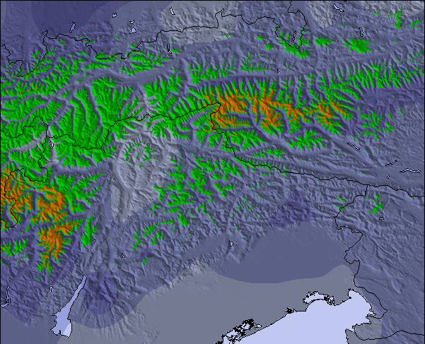
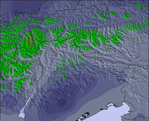
Snow map |  |  |  |  |  |  |  | ||||||||||||||
cm | — | — | — | — | — | — | — | — | — | — | — | — | — | — | — | — | — | — | — | — | — |
mm | — | — | — | — | — | — | — | — | — | — | — | — | — | 1.0 | 1.0 | — | — | — | — | 5 | 5 |
max°C | -10 | -5 | -6 | -5 | -2 | -3 | -1 | 0 | 0 | 2 | 3 | 2 | 5 | 6 | 4 | 5 | 7 | 5 | 3 | 5 | 4 |
min°C | -11 | -7 | -7 | -6 | -3 | -4 | -3 | -1 | -1 | 1 | 3 | 1 | 3 | 6 | 2 | 3 | 7 | 2 | 2 | 5 | 2 |
chill°C | -11 | -11 | -12 | -9 | -6 | -8 | -7 | -5 | -6 | -3 | 0 | -3 | 0 | 4 | -1 | 0 | 4 | 1 | 1 | 5 | 2 |
湿度の高い% | 81 | 74 | 75 | 54 | 73 | 60 | 61 | 74 | 68 | 68 | 81 | 66 | 54 | 74 | 74 | 52 | 53 | 64 | 78 | 79 | 93 |
凍結高度 (m) | 1300 | 1800 | 900 | 1850 | 2200 | 1300 | 2250 | 2450 | 2100 | 2800 | 2800 | 2750 | 3200 | 3200 | 3200 | 3150 | 3300 | 3100 | 2850 | 3050 | 2800 |
6:11 | — | — | 6:09 | — | — | 6:07 | — | — | 6:05 | — | — | 6:05 | — | — | 6:03 | — | — | 6:01 | — | — | |
— | — | 8:21 | — | — | 8:22 | — | — | 8:22 | — | — | 8:24 | — | — | 8:25 | — | — | 8:27 | — | — | 8:29 | |
翌 0-3 日の天気概要:
大部分は乾燥. 気温が氷点下になるでしょう (最大 0°C 土曜日の午後に, 最小 -11°C 木曜日の朝に). 風は通常微風.
翌 4-6 日の天気概要:
少量の雨 (合計 2.0mm), 大抵降る 月曜日の午後に. 温暖な気温 (最大 7°C 火曜日の午後に, 最小 1°C 日曜日の朝に). 風は通常微風.
Popular See Pages
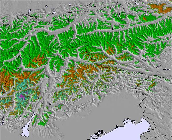
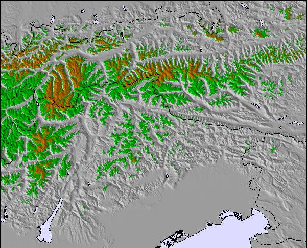
雪レーダー
レポートを提出最新の雪レポート See:
9 km 遠い See から
2 hour 前
Rain reported from Landeck at 785 metres elevation only 2 kms NW of Landeck-Zams-Fliess but it is forecast cold enough for snow at the ski area から Landeck-Zams-Fliess
25 km 遠い See から
2 hour 前Light rain showers reported from Galtür at 1577 metres elevation SSW of Galtur-Silvapark but it is forecast cold enough for snow at the ski area から Galtur-Silvapark
36 km 遠い See から
2 hour 前Snow grains reported from Oberstdorf at 723 metres elevation 5 kms NE of Oberstdorf-Söllereck Ski Resort から Oberstdorf-Söllereck
See の雪の状態
| 雪上部の深さ | 0 cm |
|---|---|
| 雪下部の深さ | 0 cm |
| 新雪の深さ | 6 cm |
| 最後の降雪 | 24 Apr 2024 |
Austriaの他のリゾートの報告: 粉雪 (5) / 状態のよいゲレンデ (5)
Snow-Forecast Partner Offers
Show your business here
雪の履歴
April月4 週の平均:
0.4 | ブルバードパウダーの日 新雪、おおむね晴れ、微風 |
|---|---|
1.0 | パウダーの日 新雪、時々晴れ、風あり |
0.1 | ブルーバードの日 平均的な雪、おおむね晴れ、微風 |
Austriaの他のリゾートの報告: 粉雪 (5) / 状態のよいゲレンデ (5)
Seeのビジターによるレビュー
全体 4.3 基づいた 1 投票 および 2 レビュー
- スノーシュア
- 様々なゲレンデ
- 投票
- United KingdomのTirolerhundが記述:
Skied See for the first time on 16 Feb. In short, another well laid out small resort with 40km of well maintained pistes backed up by a modern and efficient lift system bar one old and slow chair lift. The 1400m vertical height difference provides for a very long top to valley station run and with all the slopes facing north this guarantees a long and reliable snow cover. There is a good variety of reds and blues and a couple of blacks, which really were reds.For adrenalin freaks, the off-piste opportunities are fantastic both with challenging ski routes and some serious back country runs. Best of all, the pistes were virtually deserted. The resort is geared mostly to families and on-mountain subsistance affords great value - spag bog 8.80 euros and Weinerschnitzl 11.00 euros! At just over 1,000m, See has the lowest base station in the Paznaunertal but don't let that put you off. Definitely recommended for a long weekend or if you are staying in the Paznaunertal and want an away day from Ischgl or one the other resorts in the valley.
Seeのビジターによるレビュー
United KingdomのTirolerhundが記述:
Skied See for the first time on 16 Feb. In short, another well laid out small resort with 40km of well maintained pistes backed up by a modern and efficient lift system bar one old and slow chair lift. The 1400m vertical height difference provides for a very long top to valley station run and with all the slopes facing north this guarantees a long and reliable snow cover.
There is a good variety of reds and blues and a couple of blacks, which really were reds.For adrenalin freaks, the off-piste opportunities are fantastic both with challenging ski routes and some serious back country runs. Best of all, the pistes were virtually deserted.
The resort is geared mostly to families and on-mountain subsistance affords great value - spag bog 8.80 euros and Weinerschnitzl 11.00 euros!
At just over 1,000m, See has the lowest base station in the Paznaunertal but don't let that put you off.
Definitely recommended for a long weekend or if you are staying in the Paznaunertal and want an away day from Ischgl or one the other resorts in the valley.
ご自身のウェブサイトに無料で利用できるSnow-Forecast.天気ウィジェット
下記の Seeスキー天気ウィジェットを使って、無料で外部のウェブサイトに組み込むことができます。これによりSee の雪の予報と現在の気象条件の毎日の概況が分かります。フィード設定のページにアクセスし、簡単な3つのステップを踏むだけでカスタムhtmlコードスニペットを取得することができ、ご自身のサイトに貼り付けていただけます。ご自身のウェブサイトに合わせて、雪予報の高度(山の頂上、中腹、ふもとのリフト)やメートル法/ポンド・ヤード法を選ぶことができます。 クリックしてコードを取得
See の詳細な降雪予報を表示:
snow-forecast.com

 Nearest