


View forecast
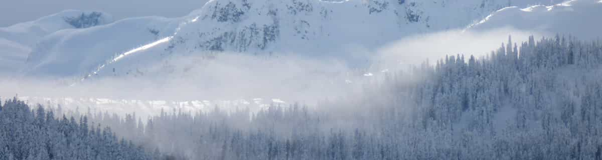
Les Fourgs at 1100 m 高度
Snow-Forecast.comによる発表: 1 am (現地時間) / 16 Apr 2024
Now
Tuesday 16 | Wednesday 17 | Thursday 18 | Friday 19 | Saturday 20 | Sunday 21 | Monday 22 | |||||||||||||||
morn- ing | after- noon | night | morn- ing | after- noon | night | morn- ing | after- noon | night | morn- ing | after- noon | night | morn- ing | after- noon | night | morn- ing | after- noon | night | morn- ing | after- noon | night | |
にわか雪 | にわか雪 | 小雪 | 小雪 | にわか雪 | 少量の雪 | にわか雪 | にわか雪 | にわか雪 | 曇り | 小雪 | 少量の雪 | にわか雪 | にわか雪 | にわか雪 | 一部曇り | にわか雨 | 晴れる | 晴れる | 一部曇り | 曇り | |
km/h | |||||||||||||||||||||
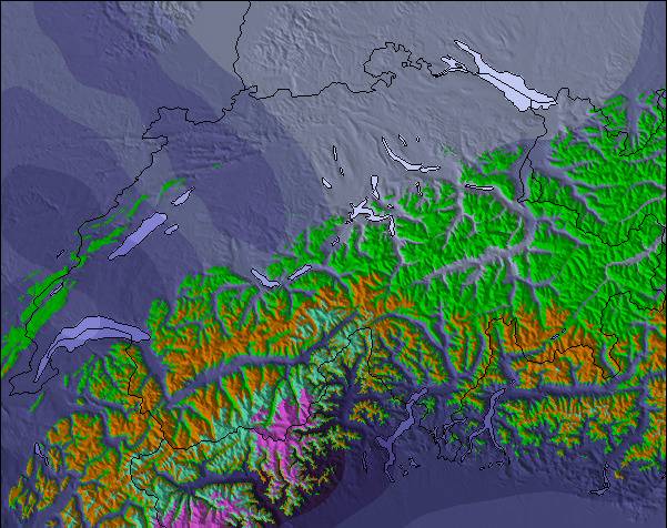
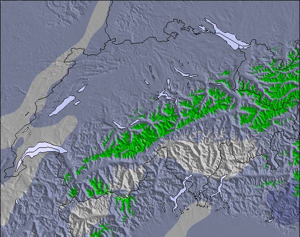
Snow map |  |  |  |  |  |  |  | ||||||||||||||
cm | 1.0 | — | 4 | 1.0 | 1.0 | 6 | 1.0 | 1.0 | — | — | 1.0 | 8 | — | — | — | — | — | — | — | — | — |
mm | — | — | — | — | — | — | — | — | — | — | — | — | — | — | — | — | 1.0 | — | — | — | — |
max°C | 1 | 1 | 0 | -1 | 1 | 0 | -2 | -1 | -2 | 1 | 2 | 1 | 0 | 2 | 0 | 1 | 4 | 1 | 3 | 7 | 4 |
min°C | 0 | 1 | 0 | -1 | 1 | -2 | -3 | -1 | -5 | -2 | 1 | 0 | -1 | 0 | -2 | -1 | 3 | -2 | 0 | 6 | 2 |
chill°C | -7 | -5 | -6 | -6 | -3 | -8 | -9 | -5 | -10 | -4 | -5 | -5 | -4 | -4 | -8 | -7 | -2 | -8 | -6 | 3 | 0 |
湿度の高い% | 91 | 91 | 99 | 97 | 85 | 98 | 93 | 92 | 84 | 84 | 98 | 99 | 91 | 89 | 89 | 91 | 77 | 78 | 72 | 61 | 92 |
凍結高度 (m) | 1150 | 1150 | 1150 | 950 | 1150 | 950 | 750 | 900 | 0 | 1150 | 1300 | 1350 | 950 | 1250 | 1000 | 1150 | 1450 | 1150 | 1350 | 1900 | 1750 |
6:43 | — | — | 6:41 | — | — | 6:39 | — | — | 6:37 | — | — | 6:37 | — | — | 6:35 | — | — | 6:33 | — | — | |
— | — | 8:23 | — | — | 8:24 | — | — | 8:27 | — | — | 8:28 | — | — | 8:30 | — | — | 8:30 | — | — | 8:31 | |
翌 0-3 日の天気概要:
穏やかな降雪、最大 水曜日の夜に. 凍結融解の条件 (最大 1°C 火曜日の朝に, 最小 -5°C 木曜日の夜に). 風が弱くなる (新風 西から 火曜日の朝に, そよ風 北北東から 木曜日の夜までに).
翌 4-6 日の天気概要:
新雪による少量の積雪 金曜日の夜に 霧雨になる 日曜日の午後に. 凍結融解の条件 (最大 4°C 日曜日の午後に, 最小 -2°C 金曜日の朝に). おもに 新風.
Popular Les Fourgs Pages
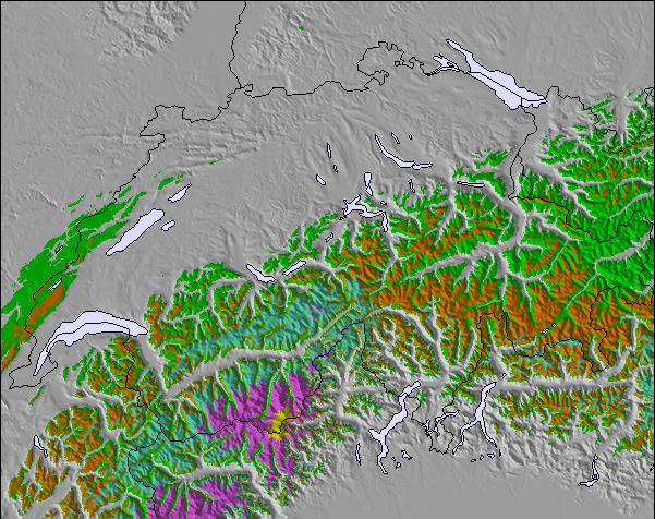
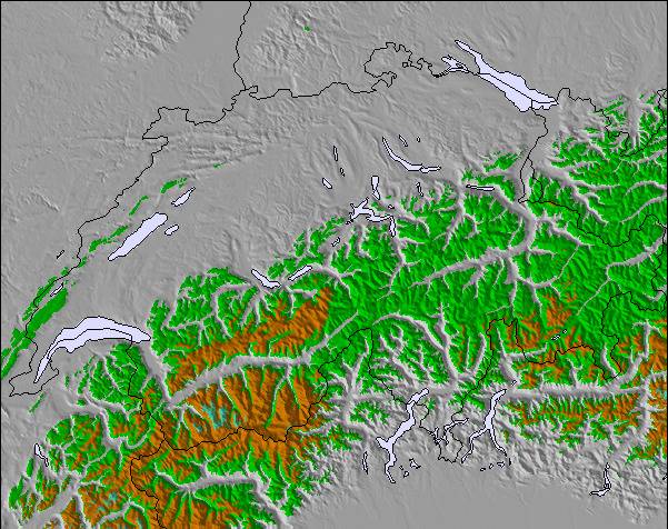
雪レーダー
レポートを提出最新の雪レポート Les Fourgs:
42 km 遠い Les Fourgs から
1 hour 前
Light snow reported from Les Eplatures Airport at 1011 metres elevation only 2 kms S of La Chaux-de-Fonds Ski Resort から La Chaux-de-Fonds
42 km 遠い Les Fourgs から
3 hour 前Light snow reported from Les Eplatures Airport at 1011 metres elevation only 2 kms S of La Chaux-de-Fonds but it is probably falling as rain at the bottom of the ski area から La Chaux-de-Fonds
42 km 遠い Les Fourgs から
5 hour 前Drizzle reported from Les Eplatures Airport at 1011 metres elevation only 2 kms S of La Chaux-de-Fonds but it is forecast cold enough for snow at higher elevations in the ski area から La Chaux-de-Fonds
Les Fourgs の雪の状態
| 雪上部の深さ | — |
|---|---|
| 雪下部の深さ | — |
| 新雪の深さ | 2 cm |
| 最後の降雪 | 15 Apr 2024 |
Franceの他のリゾートの報告: 粉雪 (0) / 状態のよいゲレンデ (0)
Snow-Forecast Partner Offers
Show your business here
雪の履歴
April月3 週の平均:
0.0 | ブルバードパウダーの日 新雪、おおむね晴れ、微風 |
|---|---|
0.1 | パウダーの日 新雪、時々晴れ、風あり |
0.0 | ブルーバードの日 平均的な雪、おおむね晴れ、微風 |
ご自身のウェブサイトに無料で利用できるSnow-Forecast.天気ウィジェット
下記の Les Fourgsスキー天気ウィジェットを使って、無料で外部のウェブサイトに組み込むことができます。これによりLes Fourgs の雪の予報と現在の気象条件の毎日の概況が分かります。フィード設定のページにアクセスし、簡単な3つのステップを踏むだけでカスタムhtmlコードスニペットを取得することができ、ご自身のサイトに貼り付けていただけます。ご自身のウェブサイトに合わせて、雪予報の高度(山の頂上、中腹、ふもとのリフト)やメートル法/ポンド・ヤード法を選ぶことができます。 クリックしてコードを取得
Les Fourgs の詳細な降雪予報を表示:
snow-forecast.com

 Nearest